Welcome to our walking tales join us as we wonder through woods, marching the meadows, hike up hills, casually saunter the coast line while exploring the flora fauna and wildlife along the way.

Tuesday, 16 July 2013

Stanley cicular via Leadgate


15th July 2013Stanley to Leadgate cicular 11mls
A short drive took us to our staring point today, Stanley, where from the car park we immediately joined the Consett and Sunderland Railway path. This also forms part of the Coast to Coast cycleway resulting in comfortable walking surface for a considerable part of our walk. Being a disused railway track the usual flowers/weeds were in bloom, Rosebay Willowherb, white and Red Campion and Fat Hen to name just a few. 
If our walk had a theme today it would be butterflies. I cannot recall another outing when so many butterflies were our constant companions, it was impossible to walk more than 50yds without disturbing at least half a dozen and they were all busy feeding or dancing duets together making it difficult to photograph and identify them. At one spot where we stopped to take in the scenery I counted 20 butterflies in a small area.


It was a hot day with clear blue skies and soaring temperatures so we took advantage of any picturesque spots to stop and keep hydrated the first one being a small fishing lake, a little oasis hidden away on the edge of an industrial estate.
Who's looking at the world through rose coloured glasses?


 Continuing along the cycle way we found further evidence of the industrial heritage of the area in the form of two huge metal sculptures “Him and Her”, it was here we saw a Red Kite circling high above us floating on the thermals to me a much more impressive site.
We left this path when it reached the main road, A693 and crossed over along the edge of Leadgate and entered Billingside Plantation for the return loop to Stanley.
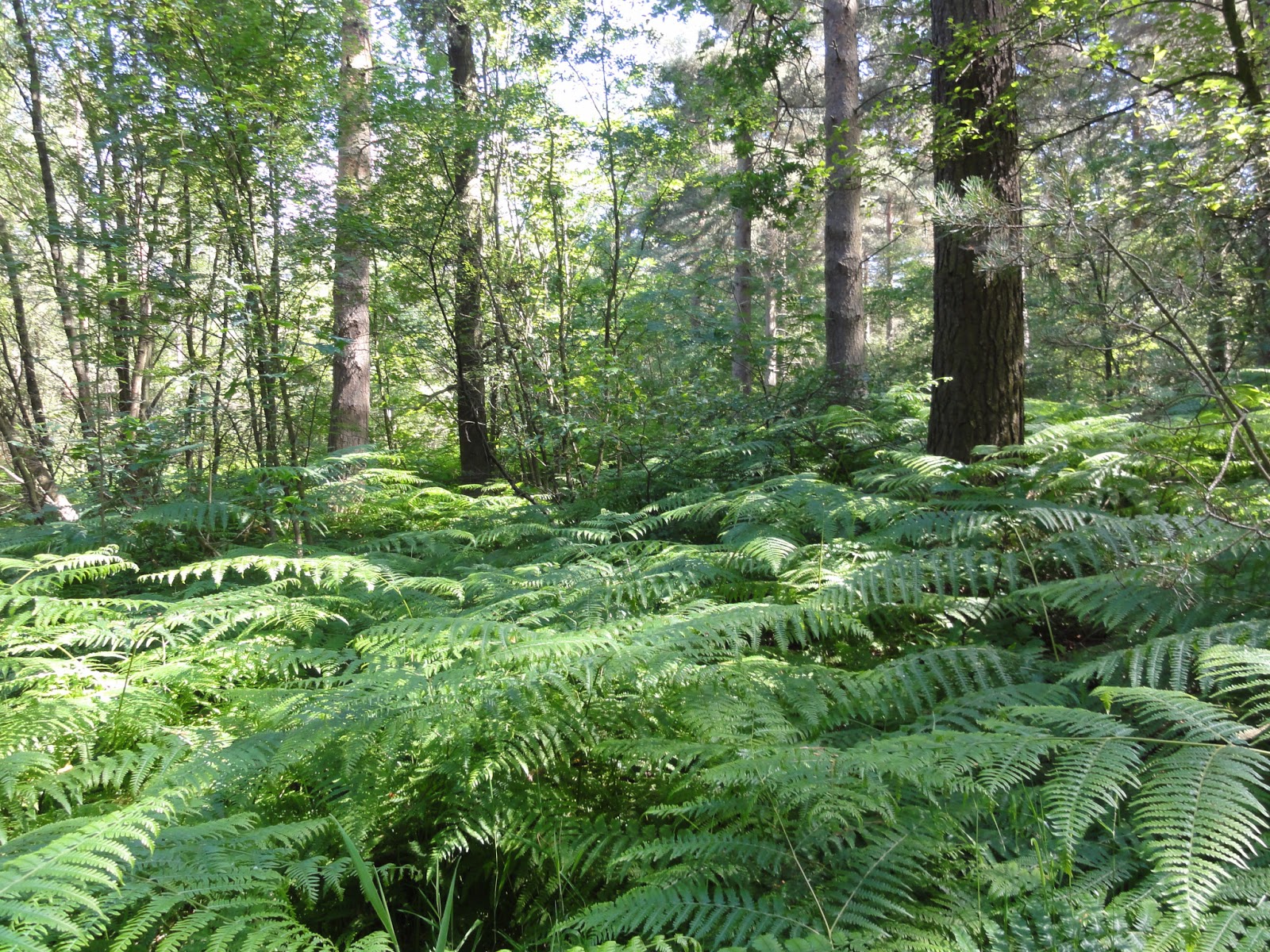
 

It was a welcome reprise from the sun and the heat to be under the canopy of the lush large trees. Instead of nettles encroaching on our path it was the soft, smooth, cool ferns that surrounded us, if fact it felt like a scene from Jurassic Park, seeing a brachiosaurus would not have been out of place here.
 
  It must have been an ancient woodland as a little further on we stumbled upon what look like pre historic dwelling ( or maybe number 4 in National Trust 50 things to do before your 11 ¾ years) I’ll let you decide!

Leaving the woods we followed the edge of the fields towards Pontop Fell here there was a radiating vibrant golden colour across the meadows but not from the buttercups of a couple of weeks ago, the predominant flower today was Bird’s foot trefoil. 

No wonder there are so many butterflies about with such an abundant food supply. Continuing on, whether by luck or good planning we entered Catchgate village where we were able to buy an ice cream this give us an extra spring in our step to see us on the final leg back to Stanley. 
Who lived here?

 Good points of today; a good distance covered in very warm weather that bodes well for the Camino.
Downside I lost my binoculars!   


Wednesday, 10 July 2013

Fatfield to Sunderland


 9th July 2013 Fatfield to Sunderland 10.5 mls (Camino – 77days)
It was a very convenient start for our walk today – home, and public transport back so not only feeling fine after a walk we also had the satisfaction of knowing we had on this occasion reduced our carbon footprint making it a good day. Heading down towards Fatfield we crossed the bridge and joined the River Wear Trail passing under the impressive Victoria Viaduct to Cox Green.

 This tidal stretch of river was at low ebb making it a popular feeding ground for black headed gulls, ducks, herons and oyster catchers. From here we took the top path up and around Washington Waterfowl Centre where the dominant sound was of young children having fun on their summer school trip. Having visited the centre previously I can recommend it for a fun and interesting day out. It was back into the woods following the river and again we were disappointed by the poor state of the footpaths. They were overgrown and many of the wooden steps breaking up but we were enchanted by a “chime” of wrens

The family name Troglodytidae is derived from troglodyte, meaning “cave-dweller", and the wrens get their scientific name from the tendency of some species to forage in dark crevices. The wren is also known as “kinglet”, a name associated with the fable of the election of the "king of birds". The bird that could fly to the highest altitude would be made king. The eagle out flew all other birds, but he was beaten by a small bird who had hidden in his plumage, and is apparently motivated by the yellow "crown" sported by these birds. Although they are insect eaters they still left plenty to feast on us, and to prove it we still have the marks days later!

Arriving at the half way mark we went under the busy A19 looking forward to lunch at the Shipwright Arms only to discover it opened at 4pm each day. Disappointed we went down to the riverside and ate what little food we had before continuing  on. From here the character of the walk changed quite dramatically from fields and woods to urban modern industrial developments and evidence of the historic industry of Wearside could be seen particularly near the Stadium of Light. Information about mining, ship building and the lime kilns were all displayed. Very soon we arrived in the busy centre of Sunderland and after a “pick me up coffee” we found the bus station and headed for home.


Tuesday, 9 July 2013

West Rainton to Durham


 29th June 2013 West Rainton to Durham 11mls (Camino – 84 days)
We seemed to have explored all the local circular walks of suitable distances and in order to get the required miles in we have to resort to linear ones and rely on good local transport links.
Today’s walk could have been called the nettle walk or the walk of a thousand stings. I am not joking in quite a few places the paths we over grown with very aggressive nettles.

We parked the car in West Rainton and immediately joined the footpath out of the village and across the busy A690 onto the field path leading to Moorsley road via Field House farm. The crops had been planted to the edge of the path and with the soil being very sandy the footpath was uneven and crumbling making the walking slow and uncomfortable. The last thing we want is to sprain an ankle at this stage of our Camino preparation!
The path then brought us to the pleasant small village of Low Pittington where there was a short steep climb to Pittington Hill that give wonderful panoramic views over County Durham and also provide a welcome seat so we could enjoy our coffee break in comfort and appreciate the flowers and the butterflies.


Suitably refreshed we set off down through the woods emerging at the edge of High Pittington. It was along this section heading for Sherburn Village that we encountered the dreaded thistles almost blocking our path but we are a tenacious couple and so we battled through.

Passing through Sherburn we rejoined the footpath along farm fields keeping our distance from the curious cows, suspicious sheep and inquisitive horses, they all seemed to know I had food in my back pack!
Anyone seen a Cathedral?

After crossing the bridge over the motorway we soon joined the river and could see our destination only our path was blocked and we were unable to follow the river side due to storm damage and we had to go up (groan) and through  Pelaw Woods eventually dropping down to the river and into Durham.


 Due to the extra bit of climbing at the end I felt the need for a cup of tea before heading to the bus station for the number 20 back to West Rainton.

Sunday, 30 June 2013

Rainton Meadows Circular


24th June 2013 
Rainton Meadows Circular via Lumley and West Rainton 9.5 miles
(Camino -91 days)
The task today was to plot a circular course from Rainton Meadows of at least 9 miles on tracks new to us and in a very short space of time the route master produced the goods.
Today we left the park heading towards Chilton Moor, the path followed a small steam that could have been called the yellow brick road due to the abundance of Yellow Iris.

 The Yellow Iris, also known as the Yellow Flag Iris, is a true aquatic plant that is native to England. It is the only yellow-flowered iris and reaches up to 48" in the wild truly spectacular here at Rainton.
Talking of flowers in only a week there is a subtle difference in the late spring flowers in the meadows, last week they were magnificent and golden, today less so the predominant colour being a rich red from the clover that is becoming dominant.

The dominant birds in this area were swallows and house martins feasting on the insects that previously had been feasting on us!
Following the map closely we had to diagonally cross a field of wheat, and I’m very happy to say this farmer was maintaining the footpaths on his property to a high standard, he had cleared the way wonderfully. I thought this is how it must have been for Moses although his sea was Red ours was green

 However this was not the case a few mile further on. Passed Morton Grange Farm, where Oscar the tame and elegant peacock lived, we attempted to follow the footpath but it was so overgrown it would have been death by nettle stings,
 they were over 3 foot in height with needles about an inch long. 
After a “risk assessment” we back tracked and joined the road for half a mile to get us back on track. The stretch alongside Whitehouse Farm had grass growing over 4 foot which made very heavy going, obviously these paths are rarely walked so walkers beware!

After that the return via Leamside and West Rainton was easy going and pleasant with only one heavy shower to shelter from. A good walk and respectable Camino training distance covered.  

Tuesday, 25 June 2013

Rainton Meadows to High Moorsley


Rainton meadows and High Moorsley 17th June 2013  (Camino-96 days) 7 miles

Blessed with good weather again we were able to don our boots and head for are local starting point at Rainton Meadows.
Our destination, High Moorsley would require a little more effort with some steady climbing, so we just kept on telling ourselves the views would be worth it

We left the nature reserve along the “Coalway Trail” then crossing under the A690 joined the Great North Forest Trail along the edge of East Rainton. This was a flat easy going section very popular with dog walkers judging by the number we passed.


Climbing over an authorised style giving access to a narrow tree lined path we found our way blocked by 2 large horses. My brave companion slowly moved forward to “shoo” them on and very reluctantly they walked forward and we followed at safe distance until I was shouted at to “move off the path” I quickly jumped into the over growth of nettles when another horse from behind me thundered past! I swear the ground shook (and me also). At this point we made a hasty retreat over the style and reached the road through another field.
Our path continued towards our high point at High Moorsley Farm next to an unusual large golf ball structure that can be seen for miles around, apparently it is the Met Office weather radar station for North East England. The extensive views were a little disappointing due to the haze on the horizon otherwise the Cheviot Hills would have  been visible.

After a little light refreshment we continued our circular route, avoiding all horses back to the car parked at the nature reserve.

Wednesday, 19 June 2013

Grasmere


Grasmere 15th June 2013 5 ¾ miles (Camino – 98 days)
At the invitation of the Annifield Plain & District field Club we had a day out to Grasmere and a very energising and lovely circular walk.
It was a very full day starting at 8am and arriving at our destination at midday.
The dark threatening clouds evident in our journey across disbursed resulting in a clear warm day but a bit hazy on the tops, making ideal walking in pleasant company.

The path leading out of the village was ablaze with vibrant colour from the showy blooms and large green leaves of the many Rhododendrons and azaleas on either side of us. (Rhododendron from Ancient Greek rhódon "rose" and déndron "tree")
The rhododendron is the national flower of Nepal, where the flower is considered edible and enjoyed for its sour taste. The pickled flower can last for months and the flower juice is also marketed. Thank goodness the Lake District chose to concentrate on Kendal Mint Cake!

Leaving the road we continued climbing through Hammerscar Plantation and were rewarded with expansive views at Huntingstile Crag towards Langdale, and then we dropped down to the village of Elterwater for a short fortifying lunch break.
Suitably refreshed we continued out of the village along the perimeter of Low Wood were some colourful small flowers were identified by one of the walkers, the yellow pimpernel and Tormentil used in the past as a herbal remedy for gastric problems.

Coming out of the woods as we walked along Loughrigg terrace there were amazing views taking in Grasmere and Rydal water which were then lost as we descended passed through the woods and joined the road back into Grasmere.
Weather wise we were very fortunate as the forecast rain started when we headed home in the comfort of the coach.

Thursday, 13 June 2013

Rainton Meadows and Mallygill Woods


Rainton Meadows and Mallygill Woods 6.5ml
Very little blog activity due to a variety of reasons so no serious walking has been done for a while. This has been a cause for concern as our intentions are to walk “The Camino” (well the last 100km to be precise) and gain our Compostela at Santiago. This will be happening mid September 2013.

With this very much in mind we have to start regular outings. My trusty companion was given the task of plotting courses, planning routes and working out walks to get us “Camino” fit.
Our outing today began at the nature reserve Rainton Meadows, http://www.durhamwt.co.uk/2011/07/rainton-meadows/  a popular local spot and ideal place to introduce young children to wild life on a sunny day.   
Walking through the reserve we passed the lakes with their usually residents, swans, Canada geese and goslings, oyster catchers, coots and moorhens an excellent opportunity for my companion to test his new binoculars.
There was a steady climb as we left the park and took the path towards East Rainton, along this path we spotted in full bloom the  Northern Marsh Orchid, also dog rose, Campion and gorse were among the abundance of early summer flowers. 
At this point we joined the Red Clover walk and continued along towards West Rainton and across the fields to Mallygill Woods.
We left the bright sun shine and entered the darker, damp, musty woods and soon came upon a magical glen, steps took us down a steep slope across a wooden bridge and as far as the eye could see the floor was carpeted in flowering wild garlic, it was as if we had stumbled upon a winter land without going through a wardrobe! 

Leaving the woods we passed Woodside farm heading towards Leamside where we stopped for a little refreshment. Our path continued through the village across the waist high field of gold, due to the buttercups, to the disused railway track which eventually led us back to the nature reserve.

Also identified on our walk the speckled wood, orange tip and wall brown butterflies.